
AI design preview — not a photo of the finished handmade doll
Land, Water & Food
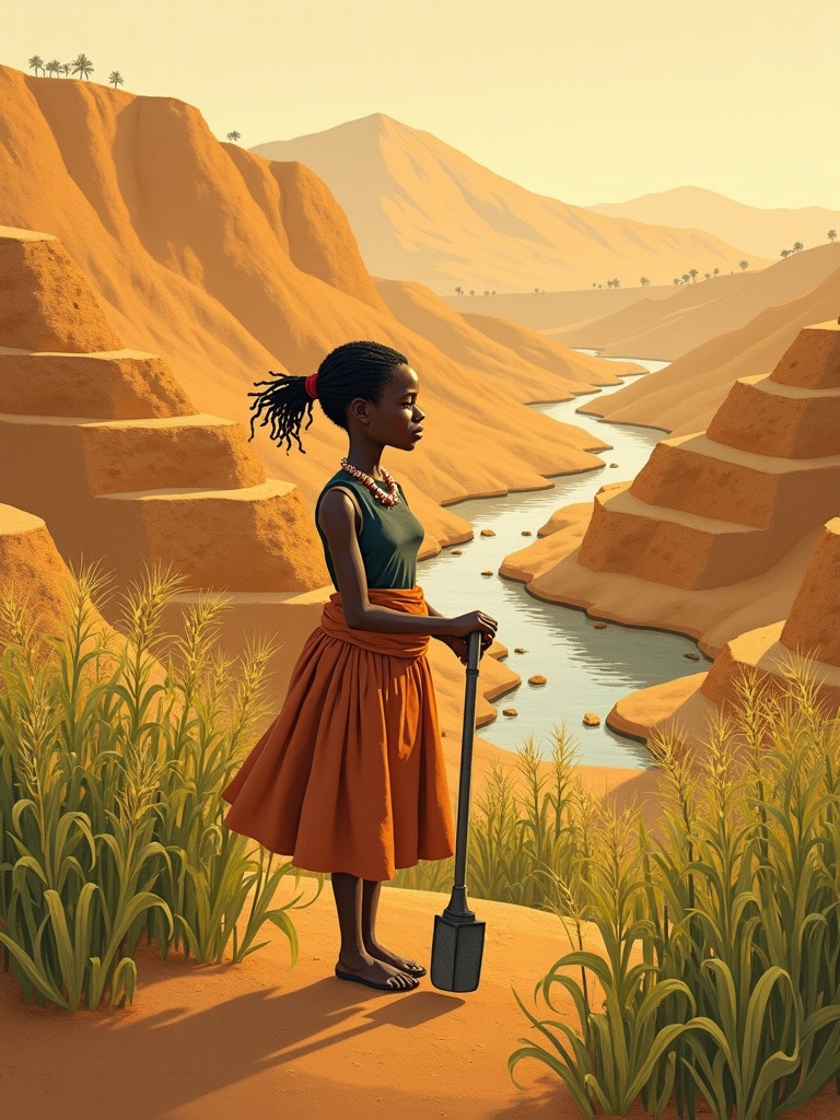
The Water-Farmer of Engaruka
She is not one person but a whole landscape of memory — the farmers, masons and water-keepers of Engaruka, who taught a dry shelf of the Rift Valley to drink from the mountains and feed thousands. The stone channels they cut still lie in the grass.
- People
- Engaruka farming community (archetype)
- Country
- Tanzania
- Region
- East Africa
- Era
- ≈15th–18th century
- Theme
- Land, Water & Food
Make your own
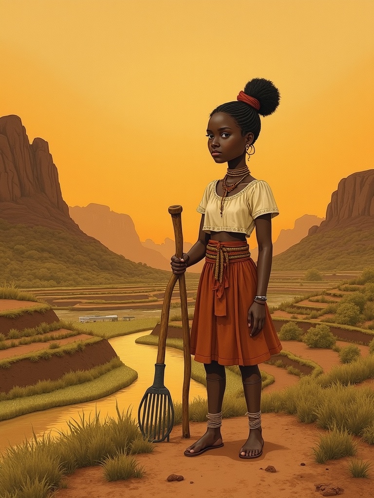
Design your The Water-Farmer of Engaruka
Pick a garment, a hairstyle and a scene, enter the PIN and generate a fresh image of The Water-Farmer of Engaruka with AI.
Each image is generated live with fal.ai.
Generated images
AI design preview — not a photo of the finished handmade doll
No images generated yet — be the first.
Tradition & Origin
She is not one person but a whole landscape of memory — the farmers, masons and water-keepers of Engaruka, who taught a dry shelf of the Rift Valley to drink from the mountains and feed thousands. The stone channels they cut still lie in the grass.
Population estimates for Engaruka range widely — from a few thousand to around 11,500 at its height — while Leakey's early figure of 30,000–40,000 is now considered exaggerated.
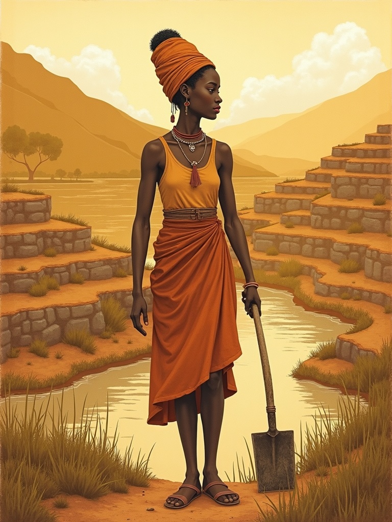
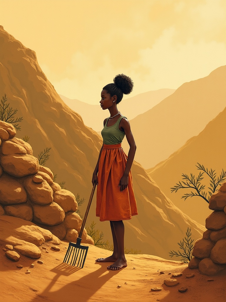
DetailsENAt the foot of the Great Rift Valley escarpment in northern Tanzania, below the volcanic Crater Highlands of Ngorongoro, lie the ruins of Engaruka — one of sub-Saharan Africa's most remarkable monuments to working the land. Beginning in the 15th century, an Iron Age farming community settled this rain-starved plain and did something extraordinary: they engineered a way to bring water to it. The Water-Farmer is a nameless archetype, a face given to the anonymous generations — the canal-cutters, the wall-builders, the soil-keepers — who made it work for some four hundred years.
The genius of Engaruka is in its stone. The community cut stone-block canals and furrows that caught the streams pouring off the rift escarpment and the Engaruka River, and led that water out across the plain to drystone terraces stepped into the hillsides. In all the system covered around 2,000 hectares — roughly 20 km² — of terraced fields, stone-lined plots, house platforms, stone circles and thousands of small drystone check-dams set at a characteristic 120-degree angle to trap silt. On these watered fields they grew sorghum and indigenous finger-millet, the carbonised grains of which archaeologists still recover from the soil.
What turns engineering into wisdom is how they kept the land alive. Irrigating dry fields for centuries usually poisons the soil with salt — yet at Engaruka there is no salt crusting at all. The farmers maintained fertility by spreading the manure of stall-fed cattle and by periodically washing fresh alluvial silt onto the plots, renewing the ground season after season. Seven villages and some 1,745 house platforms grew up here; estimates of the population range from a few thousand to perhaps 11,500 people at its height. An early guess of 30,000–40,000 is now considered exaggerated — but by any measure this was one of the great farming towns of pre-colonial East Africa.
And then, around the middle of the 18th century, Engaruka was abandoned — and we still do not fully know why. The leading explanation is that the Engaruka River and its highland streams ran thinner, until the great water-system could no longer be fed; the people were probably absorbed into neighbouring communities. Who they were is debated too: long credited to ancestors of the Cushitic-speaking Iraqw, the irrigation in fact most closely matches that of the Bantu-speaking Sonjo who still farm with hill-furrows nearby. Outsiders once refused to believe Africans had built such works — but archaeology is clear that local African farmers did. The Water-Farmer stands for all of them: an entire community remembered not by name, but by the stone and water they left behind.
Timeline
- ≈1400sAn Iron Age farming community settles below the Rift Valley escarpment at Engaruka and begins building stone irrigation channels and terraces.
- 15th–18th c.Over roughly 400 years the system grows to ~2,000 ha of stone-lined terraces, canals and check-dams across about 20 km².
- ≈1620–1720Peak occupation: seven villages and some 1,745 house platforms; sorghum and finger-millet feed several thousand people.
- ≈mid-1700sEngaruka is abandoned, most likely as the Engaruka River and highland streams ran thinner; people probably moved to neighbouring communities.
- 1913 / 1935Hans Reck, then Louis and Mary Leakey, document the ruins for outside science, beginning a century of research.
- 2001–2006British, Finnish and other archaeologists (Stump, Siiriäinen and colleagues) map the fields and test the Sonjo connection.
Did you know?
- Engaruka's stone-block canals caught water tumbling off the rift escarpment and carried it across about 20 km² of dry plain to stone-lined cultivation terraces — feeding seven villages of thousands of people.DetailsEN
- Irrigating dry fields for centuries normally poisons the soil with salt — but Engaruka's farmers kept theirs healthy with cattle manure and fresh river silt, and the plots show no salt crusting at all.DetailsEN
- Around the mid-18th century the whole settlement was abandoned for no recorded reason — the leading explanation being that the Engaruka River and highland streams that fed the irrigation gradually ran dry.DetailsEN
- Who built Engaruka is genuinely debated: long credited to ancestors of the Iraqw, its irrigation actually matches most closely the hill-furrow farming of the Bantu-speaking Sonjo who still live in the Rift Valley nearby.DetailsEN
They left no names in the stone — only the stone, and the memory of water made to flow uphill of all expectation.
Values & Capabilities
Capabilities
◆◆◆◆◆ shows how central a gift is — five diamonds mark a signature strength, fewer mark a supporting one.
She catches water tumbling off the rift wall and walks it, channel by stone channel, out to the dry plain.
Course by course she stacks dry stone into level fields that climb the hillside without slipping away.
She feeds the fields with manure and fresh river silt so the same ground can give grain year after year.
From her watered terraces rise sorghum and finger-millet enough to feed thousands.
When at last the streams ran thin, her people read the land and moved on rather than starve on dust.
Development
1 of 6 stages unlocked
A child grows up where the dry plain meets the rift wall, learning that everything here depends on the streams that fall from the highlands.
Answer all three to unlock this stage.
Unlock the previous stage first.
Unlock the previous stage first.
Unlock the previous stage first.
Unlock the previous stage first.
Crafting the doll
Her body is honest cloth and soft hand-tanned hide: a leather skirt and an ochre-rubbed hide cloak, with a beaded leather apron and a beaded collar in earth and rift-green tones. Her signature attribute is a short iron-bladed hoe and a seed gourd of sorghum, with a water gourd and a smooth channel-lining stone to mark her people's mastery of water. A little education card explains the stone irrigation channels, the drystone terraces, and how manure and river silt kept the soil alive for centuries. Sizes Classic 32 / Kidogo 18–20 / Shule 28. A share of proceeds supports Tanzanian heritage and rural water and food-security projects.
How this doll is made
The Water-Farmer's look is grounded in the material culture of an East African Rift Valley farming community: tanned-leather skirts and ochre-rubbed hide cloaks with beadwork, an iron-bladed hoe and seed and water gourds, and — above all — the engineered landscape itself of stone-lined irrigation channels, drystone terraces, check-dams and the sorghum and finger-millet they fed.
- Garments 2
- Accessories 3
- Materials 2
- Techniques 3
Garments
- Tanned-leather skirtA soft skirt of hand-tanned cattle or goat hide, the everyday dress of Rift Valley farming and herding women, worn for work in the fields and at home.DetailsEN
- Ochre-rubbed hide cloakA draped hide cloak, lightly rubbed with red ochre as adornment and protection from sun and dust — a long East African tradition still seen among the Maasai of the Engaruka plains.DetailsEN
Accessories
- Iron-bladed hoeA short wooden-handled hoe tipped with a forged iron blade; the Engaruka people were Iron Age farmers who made iron tools for cultivating their terraces.DetailsEN
- Seed & water gourdsDried calabash gourds used across East Africa to store and carry sorghum seed, grain, water and milk — light, durable and grown in the garden itself.DetailsEN
- Grinding stoneA flat lower stone and a hand-held upper stone for grinding sorghum and finger-millet into flour — the daily work of turning the terrace harvest into food.DetailsEN
Materials
- Sorghum & finger-milletHardy indigenous African grains — sorghum (Sorghum bicolor) and finger-millet (Eleusine coracana) — were the staple crops of Engaruka, recovered as carbonised grains in the excavations.DetailsEN
- Cattle manure & river siltFertility was maintained with the manure of stall-fed cattle and by periodically washing fresh alluvial silt onto the plots — a soil-care system so good the fields never crusted with salt.DetailsEN
Techniques
- Stone-lined irrigation channelsWater was captured at the foot of the rift escarpment and led across the dry plain in stone-block canals and furrows, the heart of the Engaruka system, feeding fields up to several kilometres from the source.DetailsEN
- Drystone terracing & check-damsHillsides were stepped into level fields with mortarless drystone walls, and thousands of drystone check-dams (built at characteristic ~120° angles) trapped alluvial sediment to build and renew the soil over ~2,000 ha.DetailsEN
- Sediment & water management (anti-salinisation)Some fields were kept permanently inundated like paddies while others were wetted and dried in cycles; by periodically capturing new sediment onto the plots the farmers maintained fertility for ~400 years without salt damage.DetailsEN
How it's made
Every doll is sewn by hand from natural materials — built to last a lifetime and to be repaired, not replaced. Here is the shopping list and the work steps. Sizes: Classic 32 cm (heirloom) · Kidogo 18–20 cm (toddlers, no small parts) · Shule 28 cm (school edition).
Shopping list
- Natural cotton or linen for the body (skin tone), ~0.5 m
- Wool or cotton stuffing — no plastic
- Cotton thread and embroidery floss in matching colours
- Garment fabric in this doll's colours (see the fabrics above)
- Yarn for the hairstyle
- Beads, cowrie shells and trims as shown
- Sharps and embroidery needles, pins, fabric scissors, fabric marker
Work instructions
- Trace and cut the body pattern at your chosen size (Classic 32 cm / Kidogo 18–20 cm / Shule 28 cm).
- Sew the body pieces right sides together, leave an opening, turn and stuff firmly with natural fibre, then close by hand.
- Embroider the face gently and with dignity — no plastic parts for the toddler line.
- Make the hair from yarn following the chosen hairstyle and attach it securely.
- Cut and sew the garment from this doll's fabric, then dress the doll.
- Add the beadwork, shells, trims and any attribute by hand.
- Check every seam and reinforce it — the doll should be lifelong and repairable, with no loose small parts for small children.
Origin & Ethics
How we know this
This is a respectful composite archetype, not a documented individual: there was never one 'Water-Farmer of Engaruka', and the original inhabitants left no written record of their names. The irrigation channels, drystone terraces, sorghum and millet, cattle-manure farming and mid-18th-century abandonment are well documented by archaeology; who exactly the builders were (Iraqw ancestors vs. Sonjo links) and precisely why they left remain genuinely debated. Tanzanian heritage bodies and the region's living communities, not this card, are the true authorities.
Because Engaruka is a protected national heritage site and a living landscape, this archetype should be made and shared with the guidance of Tanzanian cultural authorities — the National Museum of Tanzania / Antiquities Division and the Ngorongoro Conservation Area Authority, which manages the Engaruka Ruins — and with respect for the Maasai, Sonjo and Iraqw communities of the region. The figure is presented as a respectful homage to a whole community rather than any named individual.
Sources
- Wikipedia — Engaruka (Iron Age irrigation, stone-block canals, terraces, ~20 km², ~30,000 estimate now seen as exaggerated, abandonment mid-18th c., Iraqw/Sonjo debate, researchers Reck, Leakey, Sutton, Siiriäinen, Stump)
- Ngorongoro Conservation Area Authority — Engaruka Ruins (official: seven villages, thousands of residents, stone-block canals, ~20 km² of farmland, stall-fed cattle manure, abandoned mid-18th century)
- Lang & Stump, Geoarchaeological evidence for the construction, irrigation, cultivation and resilience of 15th–18th century AD terraced landscape at Engaruka, Quaternary Research (Cambridge Core)
- African History Extra — Who Built Engaruka? (ca. 1400–1800): Stone Architecture and Historical Controversies in Eastern Africa (sorghum, ~1,745 house platforms, seven villages, population estimates, Sonjo connection, 120° check dams)
- Stump, The development and expansion of the field and irrigation systems at Engaruka, Tanzania (ResearchGate)
- Westerberg et al., Architects of the Engaruka Techno-Cultural Complex: Testing the Sonjo Connection, Utafiti 16(2), 2021 (Brill)
- Atlas Obscura — Engaruka Ruins, Monduli (abandoned ruins of an ancient irrigation-farming civilisation in the Rift Valley)
- Ancient Pages — Mysterious Ancient Ruins Of Engaruka: Why Was The Site Abandoned? (irrigation, terraces, abandonment debate)